Showing posts with label Colorado. Show all posts

Thursday, August 16, 2012

Fitness and the Outdoors

I'm home now, feeling wistful about my days in the mountains.  It's always good to be home, see family and friends, start the intellectual wheels churning again.  But, still...  While I ate breakfast this morning, I read through a free magazine I picked up at the Boulder Farmer's Market called "Boulderganic:  Bringing self-sufficiency and sustainability home."


"In Boulder, people like to move.  While many studies suggest that group fitness and group sports might be the way to go, finding an outlet for group exercise can sometimes be a challenge-- especially in a community as transient and busy as Boulder."  So, a couple of UC alumni created a website designed to connect Boulder's "fitness community".  It's called BoulderActive.com.  You can find a person who shares your hobby, or try something new.


A separate article entitled "Can we stop loving Mother Nature to death?" provided some tips for both enjoying and protecting the wilderness.  "Coloradoans love their outdoors.  This is why people move here.  It's why people stay here.  It's why they live here.  They love visiting wilderness," says Ralph Swain, US Forest Service regional wilderness service manager.  With 3 million people living along or near the Front Range, the recreational activities effects soil, vegetation, wildlife and water. 

How do people protect the wilderness that they so love?  A few tips included- educate yourself; stay on the paths; be sure fires are out; manage food, trash and waste.  Maybe the most important thing is to keep in mind the words of The Wilderness Act.  The Wilderness Act was signed into law by President Lyndon Johnson on September 3, 1964.  "A wilderness... is recognized as an area where the earth and community of life are untrammeled by man, where man himself is a visitor who does not remain."  Read that last phrase again-- where man (woman) is a visitor.  

Wednesday, August 08, 2012

Brainard Lake

Brainard Lake
It was an adventure to reach Brainard Lake, where I wanted to hike to Lake Isabelle, a two mile walk to a spectacular alpine lake.  My GPS routed me on the Boulder Canyon Road, which is a beautiful ride through the canyon.  Midway, all traffic stopped.  After 15 minutes, I got out of my car to talk to the driver ahead of me.  He told me heard that boulders fell into the road, so workers were removing the rocks. Great.  I waited a few more minutes and then turned around to try another route. Virtually back at where I started an hour later, I drove through Lefthand Canyon, with many cyclists on the winding, climbing canyon road.  

I arrived at Brainard Lake an hour later than I had hoped.  The parking lot for the Long Lake trail (which is the trail to Lake Isabelle) was full.  I tried the Mitchell Lake parking area and thankfully a car was pulling out!  So, that's where I hiked.  Through the pine forests for a mile into the Indian Peaks Wilderness Area.  Even with other hikers, it's blissfully quiet.  Mitchell Lake is smaller than some of the others, but the scenery is still breathtaking: the lake, the pines, the Rockies.  I particularly like to notice the shift in landscape at the high elevations, since these lakes are at the timber line.  I continued on the trail another mile for a more "aerial" view of the lake and mountains.  It's tough climbing at 10,000 feet!

On the way out of the Brainard Lake Recreation Area, cars had pulled over on the left shoulder and everyone had a camera.  I found a spot and joined the group watching five large moose munching on bushes.  At first the moose were somewhat hidden except for their antlers.  Then, as if humoring us, a couple of moose moved into the clearing so we all could get better pictures!  A few large claps of thunder sent me to my car.  I drove down the mountain in the rainstorm, and onto the CO 72, the "peak-to-peak" highway to get to Nederland and back to Boulder.  (By then the Boulder Canyon Road was clear, but the indentations from the boulders were evident in the road!) Another lucky day here in the West. 


Moose!

Wednesday, August 01, 2012

Mt. Sanitas


When I asked locals here in Boulder where to hike nearby, everyone mentioned Mt. Sanitas.  So, I chose that trail to hike with my colleague's cousin who lives in Boulder whom I was going to meet for the first time.  She's an art teacher, an athlete and is familiar with this trail.

There are two main ways to get to the top of Mt. Sanitas- the Sanitas Trail up which is vertical over rocks and dirt,  or the Ridge Trail which is a packed dirt path for most of the way.  We decided to make a loop, up the Sanitas Trail and down on the Ridge Trail.  

For a novice such as myself, the trail was challenging and invigorating!  I had to watch my footing most of the way, stopping periodically to admire the view, catch my breath, and take in some water. It took us about 45 minutes to reach the top, a climb of 1255 feet.  The view is spectacular and it certainly felt like an accomplishment for me.  The hike down starts over more rocks until the trail becomes an easy walk on packed dirt.  While I don't mind the uphill to reach a view, all of the scrambling over rocks is tough on the knees!


Thursday, July 26, 2012

Boulder Creek Path

This morning I ran a different portion of the Boulder Creek Path, past E. Fine Park and into Boulder Canyon.  There were many fewer people since this part of the path heads away from downtown.  I learned a bit of Boulder history- more on that another time.

Since there were some clouds this morning,  I decided it would be a good day to hike the Royal Arch Trail.  The ranger said to allow at least 1.5 hours when I previously inquired.  So, I filled my new 32 ounce water bottle, applied sunscreen, and started out.  I began on the Chautauqua Trail, then connected with Bluebell-Baird, and on to Royal Arch. The sign for Royal Arch said 1.1 miles.  Piece of cake, I thought.  I'll be to the top and back in an hour.  Hah!

The path quickly changed from packed dirt to rocks, boulders, dirt steps with logs to hold the dirt, and more rocks.  It seemed that some of the rocks had been placed to form steps.  This was no longer easy going.  Each person on the way down said, "It's worth it!"  When I felt I had climbed enough to be near the top, a couple heading down said at least 30-40 minutes more before the top of the trail and the Royal Arch itself.  How could that be possible? I soldiered on, as the saying goes.  Along the way I met another fellow hiker, George, from the Bay Area.  We chatted, climbed together, and swapped cameras. Once we reached the top, we joined others, and a few people made jokes- no elevator?  no Starbucks?  Reluctantly, we each left the relaxing perch on the rocks and headed back.


I don't know which was better- the view from the top or the satisfaction of the climb.  I was further humbled when I was later walking through the garden at Chautauqua to get lunch.  An older guy was sitting with an ice pack on his knee.  I shouted that I needed that too, after the Royal Arch hike.  He agreed that it was steep, and that he made that hike all the time.  Sigh.  He did, however, give me credit for making the climb after only a week in Boulder.

Tuesday, July 24, 2012

Boulder Falls and Nederland

After a morning hike, I needed a plan for the afternoon.  When I called the front desk to ask for a suggestion, the young woman with whom I spoke suggested Nederland- a beautiful ride, less than 20 miles, and a great restaurant for lunch.  Perfect!


The drive to Nederland goes through Boulder Canyon on Rt. 119.  It's another breathtaking ride through the mountains, literally.  There are rocks and evergreens on either side, the Boulder Creek, and cyclists, of course.  A bit more than mid-way, I saw a pull-out filled with cars, and people peering over the edge on the opposite side of the ride.  Since I was going slowly enough and there was no traffic, I pulled over, too.  What the people were looking at was the bottom of the Boulder Falls.  I joined others climbing over rocks on the walkway to get closer in to the falls.  A young couple was next to me, and the guy stated that he often went fly-fishing at the falls, and last week the water was running brown due to mud churned up by rain.  "Imagine what that would look like," he said while shaking his head.  We both continued on our walks.

Within 10 minutes or so of leaving the falls I reached Nederland, a small town that seems to spring up in the hills while you're driving.  I continued past the village area (the recommended restaurant was closed today) and went to Sundance Lodge and Cafe, where "the food is as good as the view" according to comments on TripAdvisor.  The food was good enough, but the view was unbeatable-- the Rockies and the Continental Divide.  I lingered beyond by salad and pork green chili, then went into the village.  While the houses on the hillside were quite large, the ones in town were small and in need of repair.  There were a few shops, several restaurants, a visitor's center, the post office, a bakery.  I bought a pin, tee-shirt and a "hiker's cookie" filled with cranberries, oatmeal, orange rind, and dates. While I wouldn't choose to live in Nederland, I was mighty glad I went to visit. 


The Rockies and Continental Divide


Monday, July 23, 2012

Life in Boulder

Boulder Farmer's Market
According to my Frommer's guidebook, Denver has the highest proportion of thin people than any other city in the country and a 2010 study stated Colorado is the state with the lowest percentage of the population to be overweight.  Here in Boulder, it is easy to understand why people are so fit:

There are 40,000 acres of parkland and more than 200 miles of hiking/biking trails.
There are approximately 100,000 bikes for the 100,000 residents.  Despite the hills, people bike everywhere, or are taking their bikes on their cars to bike somewhere else.
The popular Boulder Creek Path is a 16 mile stretch that runs east/west through the city and into the mountains and suitable for running, walking, biking.
There are five public pools (Three large rec. centers and two outdoor pools.  The pool at Scott Carpenter Park is a 50 meter pool.)
Rocky Mountain National Park (44 m. from Boulder) and Indian Peaks Wilderness Area (on the Continental Divide- 70 m. from Boulder) are nearby.

Even though I am in Boulder on vacation, I confess to feeling a bit of pressure!! Yesterday I wanted to go for a short run on the Creek Path.  My calves were sore from hiking.  But, a short run didn't seem enough, so I pushed an extra mile or so.  It was almost as if I was worried that the recreation "police" would evict me from their fine city!  

Tubing and wading in Boulder Creek

Clearly, children are raised into this lifestyle.  When I was strolling through Chautauqua yesterday afternoon, I walked past a kid's birthday party.  There were two entertainers, so I stopped to listen.  They were telling a story/singing about taking a walk to find birthday gifts in nature.  The one singer came across a bobcat den, which prompted a song- The Bobcat Walk.  Next, the other singer sat on a log (which was actually the first singer in a log costume) which led to a song about trees and decomposers.  I left after that. At the park, there are rocks and climbing areas for kids.  Same in town.  There's also a kid's fishing pond, stocked with trout.  Kids on bikes; kids with backpacks. Recycling and trash bins are abundant, and labeled for appropriate sorting.  The bin that makes me cringe is the one labeled "landfill".

But, there is a balance, and a sadness.  Alongside of all the organic produce and gluten free products at the farmer's market are delicious breads, pastries, burgers and ice cream.  Brewpubs abound!  And, according to my guidebook and a friend, the best margaritas in the world can be found at the Rio Grande in downtown Boulder.  As elsewhere in the world, Boulder is not immune to a problem with homelessness.  In the parks, along the creek path, and in the streets, are many homeless people.  Perhaps this healthful-minded city will find a solution.


Saturday, July 21, 2012

The Flatirons


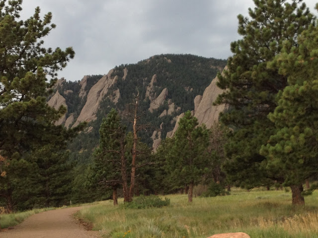
The small "village" of the Colorado Chautauqua sits at the base of the Flatirons, five mountains that resemble old-fashioned irons. The rocks are made of sandstone, approximately 290 million years old.

I wasn't going to hike at all today because my calves are sore from the hills of the last two days.  But, outside my door are miles of trails and these incredible mountains.  So, after a short run on the Boulder Creek Path, I ate breakfast, laced up old running shoes, and headed into the hills again.  I'm beginning to understand the lure of long days on the Appalachian Trail, or any other trail.  

I finished reading A Sense of an Ending by Julian Barnes.  To coincide with my stay here in the mountains, tomorrow I plan to start Wild: From Lost to Found on the Pacific Crest Trail by Cheryl Strayed.


Thursday, July 19, 2012

Colorado Chautauqua

A Brief History- The Chautauqua Movement is named for the Chautauqua Institute on Lake Chautauqua in western NY state.  The movement started in 1874 as a summer school for Sunday school teachers, and quickly spread to include all kinds of adult education.  Many towns, especially in rural areas, began to establish "chautauquas"- gatherings for educational, cultural and recreational activities.   At its peak in about 1915, approximately 12, 000 towns had hosted a chautauqua.  

The Colorado Chautauqua began as a partnership with the Texas Board of Regents in the late 1890's.  The city of Boulder agreed to provide land, facilities and public utilities to create a summer school for teachers.  The location was selected for its "spectacular mountain setting and cool climate".


Today, the Colorado Chautauqua is the only continuously operating chautauqua west of the Mississippi, the only year round Chautauqua, and the only one whose grounds are free and open to the public.  There are numerous hiking trails, an auditorium featuring popular concerts and lectures, and a "dining hall" with a wrap-around porch for viewing the evergreens and mountains.  A visitor can rent an apartment, a cottage, or an entire lodge for a family reunion.


My note- After only one day at C.C., I will say it's incredible.  Last night, I sat on the porch of the dining hall and had Rocky Mountain trout with white grits and green beans, followed  by Berry Pie.  Today (Wednesday) I started the day with a cup of tea in my hand, soaking in the fresh air and mountain views.  Then, I took a hike, first on Bluebell Trail, then on Mesa Trail.  I walked to Boulder (all downhill), browsed, and shopped for groceries.  Laden with bags, I took a cab- too much to carry all uphill!  After dinner I went for a stroll through the grounds.  It was quieter tonight than last night since there was no concert, but still many people were dining, walking, hiking. 

Rest Stop in Sedgwick

The ride across Nebraska on Rt. 80 is flat, predictable, and awe-inspiring.  There are acres upon acres of farmland and open space.  On the highway, there are trucks and service areas.  All very predictable.

Once I crossed into Colorado, though, I had to leave Rt. 80 and take Rt. 76 to head southwest toward Denver and Boulder.  I think there should be a warning sign at the entrance on to Rt. 76.  Something like:  "Be sure you have a full tank of gas, and do not panic.  You will not see any signs of habitation for miles, but eventually you will."  A sign like that would be reassuring because Rt. 76 is empty. There were a few cars and trucks, which I was glad about, but that was all.  Even though I had a half tank of gas, I started to get tense. 

When I reached the town of Sedgwick and saw a sign for gas, I pulled off the highway.  There was a dusty parking lot, a small cafe, a gas station (with a spotlessly clean bathroom) and a boarded up building across from the station.  I was prepared to pump my own gas, but I was unprepared for a gas pump that had a lever on the left side that I had to pull toward me first in order for the gas to flow.  Honestly, I stood a couple of minutes, tried the pump, and with a stroke of luck got it to work.  When I went to pay, the woman inside the station chuckled and said, "I was about to come out and help you, but you figured it out."  


Saturday, July 14, 2012

The Great American Road Trip


For years, I fantasized about driving cross country, NJ to California.  The southern route, the northern route.  I followed the blogs of the NY Times writer, Matt Gross, as he drove east to west, often to lesser known spots.  It seemed like such a grand adventure.  I had never gone cross-country in my 20's, but I could do it now that my kids were grown.   Then, the negative thoughts would surface:  sitting for endless hours; the cost; safety issues; the wear and tear on my car; maybe too much time alone. 

In April, I traveled to Colorado with a friend.  We went to Denver, Colorado Springs, and Boulder.  I fell in love with Boulder, which is no surprise to anyone who knows me.  I knew I wanted to return for an extended time.  When I got home, I did some research, weighed out the cost and convenience of flying vs. driving.  I talked with family and friends.  I checked with my mechanic.  Finally, I would take the drive, though ending in Colorado, not California.  Good enough!

Stop #1- Chicago to spend the weekend with my daughter.  Taste of Chicago and the beach (Lake Michigan).  The drive took a bit longer than I thought it would, but overall smooth going.  NJ- Pennsylvania- Ohio- Indiana- Illinois.  Route 80 W. all the Chicago, then route 90 W. into the city.  It's great to be here, for endless reasons.